 |
| An open slope surrounded with mountain's range |
-------------------------------------------------------------------------------------------------------------------
We took the Philtranco bus ride to Iloilo. The long queuing time at seaports (Batangas and Roxas City), were some factors of delay. Similar to most of UGAT's climbs, it turned out to be an open scheduled trip.
 |
| At the roro going to Calapan |
 |
| Touch Down |
 |
| Culasi at dusk and the Malalison Island |
 |
| Preparation of dinner |
We commenced the hike at 5 in the morning, as suggested by Josue (guide coordinator), to avoid the scorching heat at the open slopes. The first part of the trail to Camp 1 is composed of grasslands with moderate assault, followed by forested trails with uneven terrains and thorny plants (Rattan).
The Open Slopes
 |
| Take 5 |
 |
| Aling Simang at the grasslands |
 |
| The landscape of the open field |
 |
| A lagoon. The last part of the open trail |
 |
| A shaded part with continuous assault |
 |
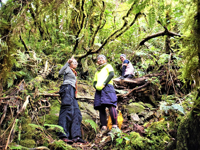
| Joy, The Lady of the Forest :o |
It was only 11 AM by the time we arrived at Camp 1. Initially, our plan was to reach camp 3 to have ample time for the side-trip. Josue said that we can't make it to camp 3 and suggested to resume the hike at dawn the next day. We just settled at camp 1 and the remaining time were used for socials.
 |
| One of our guides on the 3 days hike. He was able to join us up to the summit; a very agile new found friend. |
 |
| Tent Pitching |
 |
| Discussion with Josue and cheering moments with other hikers |
 |
| Food Preparation |
After consuming a bottle of Alfonso, the cold flows of river enlivened the day...
 |
| Clear Running Water |
 |
| Jerico at the natural bathtub |
 |
| Beside the river |
We resumed the hike at 5 in the morning packed-light. The plan to exit via old trail was altered; instead, we passed through the same route (new trail) during our descent.
The trail during the second day is more challenging; a continuous 4-wheeled assaults in mossy forest. There are parts where we need to pass on edges of precipice. A stunning scenery awaits at the higher ground (provided that there's a clearing).
 |
| Rope Segment. There's only one segment in the entire trail (around 20 to 25 ft.). Our guide mentioned that they made a new route, to avoid the steeper one. |
 |
| Libog Falls taken at different time. According to the local, Libog means "honey or mahal" in their dialect. |
 |
| The Three Musketeers. They were the fast pacers of the group: Luisa (Pot), Darwin, and Trixie |
 |
| At a view deck (there was no view!) |
Most of the trail from this point until we reach the summit comprised of wet soils and mossy forest.
 |
| A garden of moss near the summit |
 |
| Rommel the Treeman |
 |
| Wild Plants |
We had no clearing but still, it was a successful assault. The summit can only accommodate few climbers; it is a steep point with loose soils. In a better day, there is a 360-degree view of mountain ranges.
 |
| Group Picture at the summit |
 |
| Rommel at the other side (tree-top) |
 |
| Late lunch at Camp 3. Time Check: 1:00 PM |
Day 3 (April 15)
After logging out at 11 am, we went to the nearby Malalison Island as our side-trip.
The Descent
 |
| Group Picture at the Grassland |
 |
| Gold Eagle. A classic drink after an arduous hike |
 |
| UGAT conquered Mt. Madjaas! |
 |
| Last picture with "Chupuppy", our 15 years old guide. See you in other times! (kapag hindi ka na makulit :D) |
 |
| On the way downtown |
A common destination after a climb due to its proximity. The island has an extensive beach front of white sands and generally less-crowded. Taking the approximately 1.5 hour hike to a hill is another activity, where one can have scenic views of the entire island and encounter with pitcher plants (we already had enough lolx).
 |
| Going to the Island |
 |
| Arrival |
 |
| Cheers |
 |
| At the beachfront |
 |
| Random Pics |
 |
| Random Pics |
Two roads diverged in a wood, and I — I took the one less traveled by, and that has made all the difference. – Robert Frost
Actual Itinerary
April 11, 2017 (12 midnight): Departure Manila (via Philtranco) to Culasi, Antique
April 12, 2017: Travel time, registration, overnight at the village
April 13 (5:00 AM) to April 15 (9:00 AM): Climb Proper
April 15, 2017 (Afternoon): Side-trip to Mararison Island (Overnight)
April 16, 2017 (10:00 AM): Departure to Manila (Via Ceres Transport)
April 17, 2017 (12:00 PM): Arrival Manila
Some Major Expenses
Guide Fee: 600 Php per day
Porter Fee: 500 Php per day
Habal-habal: 150 Php per head
Terminal Fee and Environmental Fee (Malalison): 30 Php per head
Pump Boat to Malalison: 750 Php per ride (good for 8 to 10 pax)
Worth remembering (a personal thing to look back)
- Candy at roro going to Roxas
- Darwin Rocks at night (Malalison)
- Roderick circled the tree (Malalison)
- Bangkero's Night
- The repeating phrase: "Simang/Kath Mahal Kita" (Malalison)
- "Nasa Cubao na po" - Trix (Malalison)
- The hypertensive Paulo
Safe Budget for a group of 10: more or less 5k per head (including the side-trip)
Photo Credit: Aling Simang, Rommel Dalisay, Mary Joy Tan, Paulo Marte
End
-JSC


