Tuesday, September 27, 2016

Maysawa Circuit and Nagpatong Rock Formation (1st Tower) // September 25, 2016

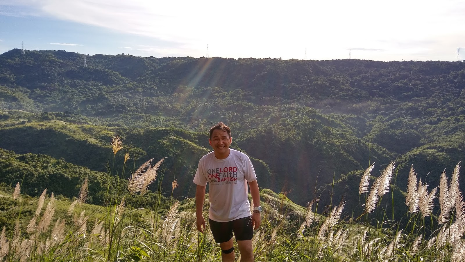
Picture taken from one of Mt. Binutasan's Summit

A sea of clouds, grassy slopes, a glimpse of nearby mountains, and trails comprised of bamboos and tall grasses.  These are some of the things which a new place in Tanay, Rizal can offer to hike enthusiasts - "The Maysawa Circuit".  It is under the supervision of Brgy. Cuyambay; the same locality in charge of Mt. Paliparan.  The entire trail is composed of 2 mountains: Mt. Sapari and Mt. Binutasan.  If the twin hike is not yet enough to satisfy one's wanderlust, a side trip to Nagpatong Rock Formation is a feasible day tour combination.       

The Hike 

We made a comeback 2 weeks after our Mt. Paliparan Hike.  In order to include the Nagpatong Rock Formation in our itinerary, we left Manila at 2:00 am and arrived at the Brgy. Hall of Cuyambay at 3:45.  The registration fee for the 2 locations is 50 pesos.  The jump off of the Maysawa Circuit is located at the other side of the highway.  At 4:15 we commenced the hike.  We preferred to go first in Mt. Binutasan to catch-up the sea of clouds.  


Muddy Trail
The trails on both mountains can become very slippery and muddy during the rainy season; added to the thrill is the existence of limatiks in the first part of the trail.  

Mt. Binutasan

We reached the series of peaks of Mt. Binutasan at 6 am.  Overall, it has 4 peaks.   The name Binutasan was originated from a man-made tunnel a long time ago.  According to our guide, hikers and even the locals of the place are forbidden to explore the area due to safety.


Group picture: Aries, She, Me, and Santy


Descending from peak 4

Batis


This is the place where most hikers are having a stop-over.  The cold running water and the serenity of the place is truly a great reward after the hike.  There is a nipa hut located at the upper part.  Coconuts can be avail at 25 pesos; other snacks are for sale at higher prices :p

The Nipa Hut


are those berries edible?


We stayed in the place for an hour and went to Mt. Sapari.  

Mt. Sapari

Our guide mentioned that the mountain was named after a priest who once resided the place.  In the end, he was assassinated.  The summit of Mt. Sapari has a small rock formation.  Honestly, I appreciated more the scenic views of the nearby mountains on our way up.  

Santy (where is love?)


She at the summit

Another rock formation located on the summit 

We took some photo-ops and went back to the jump-off (highway).  Along the way, we encountered some horses that are available for a ride at a cost of 150 pesos until reaching the habal-habal terminal.  The habal-habals are charging 30 pesos per head up to the highway.  We decided to walk.   We had our lunch in the lomi house located at the beginning of the trailhead.  Prices of meals are ranging from 30 to 70 pesos.  Souvenir bag tags and shirts may be avail at the shop.   After 45 minutes, we proceeded to the jump-off point of the Nagpatong Rock Formation.  

Nagpatong Rock Formation

The jump-off point of the nagpatong rock formation is located at the other side of the highway.  It consists of 2 towers.  The first tower is an hour away from the jump off.  The other one which is more difficult to climb is 30 minutes away from the first tower.  The trail going to the rock formation is consists of bamboos (with new sprout), razor-leafed grasses, and rocks scrambling.  Good thing I brought my gloves.


A community in the jump off point

Is this a fruit???
I did not reach the peak of tower 1 since I had problem with my shoes.  It became very slippery when I step on stone.  I just stayed on the base of the tower.  The other 3 made it on the top.  (Better luck next time)...

The summit of tower 1


Aries and tower 2 at the background
We did not go to tower 2.  Aside from an impending rain, it is more on a technical climb (more on rappelling) compare with tower 1.  A rope is highly needed.  We started our descent at 3 pm.  

Overall, it was a great and exhausting hike.  I realized that I still have a very long way to go.

Thursday, September 22, 2016

Mt. Paliparan Hike // September 12, 2016


Along the trail from left to right: Santy, Dave, Me, She, and Aries
One of the newly opened hiking destinations this year is Mt. Paliparan, located in Brgy. Cuyambay, Tanay Rizal. The place is the same jump-off point of the Nagpatong Rock Formation and Maysawa Circuit (Mt. Sapari and Mt. Binutasan).  

The mountain was once a place where the Dumagat (the local tribe in the area), used to fly kites. Travelers will surely be fascinated by the forested trail, limestone formation, grassy slope, cave exploration, and waterfalls integrated in the entire hike.  

The Hike

We left Manila at 3:30 am and arrived in the Brgy. Hall of Cuyambay at 5:00.  Guide fee is the usual minimum amount of 500 pesos and 30 pesos registration fee per head.  Initially, we planned to include the Nagpatong Rock Formation in our itinerary; however, after the briefing, we decided to focus the hike to Mt. Paliparan and the falls.  We will just go back to settle the unfinished business :P

The first part of the trail is composed of flat, muddy, and forested terrain.  


A rice field

Soy Plantation according to our guide
Muddy trail
The bridge before the assault

Forested Part


Moving Up


Dave.... Statistician By Profession; Model By Passion
A view near the "Tukduan"
The Tukduan

How can I go back???
 The place where Aries was siting has some unstable rocks; one should crawl before reaching that point.  I did not attempt to go on the same spot.... #safetyfirst :P


Taguan/Cave


This small cave also called by the locals as "taguan" embodied formation of stalagmites and stalactites.  A headlamp is needed to explore the area.  The inside of the cave is cold; a perfect place to have a little rest before proceeding to the "view deck".  We stayed there for 15 minutes.

Outside of the cave
Viewdeck (Not yet the summit)


Going up up up


Going to Summit


A rock formation at the base camp
We took some snacks in this area before heading on the summit.  

a rope segment before the summit
A rope was set by the guides to make the climb easier.  It was a big help on my part; I don't know how long will it take for me to reach the summit without a rope.  We were lucky for being the last group to climb (There were only 3 groups that day). The entire place was ours...

The Summit


Dave..... what are you doing?
Aries... His third climb


The Descent

The trail going to the community (Tuoy) is composed of grassland.  The grasses are taller than us and there are existing beehives along the trail (one wrong move...).  


We are on that mountain a while ago...


A Stream


Community 


This place is also known as Tuoy,  one of the communities of the Dumagats.  Their houses are mostly made of wood materials.  Dogs, chickens, goats, and ducks are highly visible in the area.  There is a place located under a mango tree where visitors are usually having a stop-over.  The locals are selling coconut, 'biko", and rice meal at a reasonable price.  


A view of the mountain from the community
 Going Further

We did not proceed to the Tungtong falls due to an afternoon's rain.  Seeing it at a distance from a different route, perhaps we will have a second time around.  The trail from the community to the jump-off point is more on a stream crossing and grassland.  This time, some of the grasses have sharp edges which might cause some cuts.  


 This is the first falls.  It has a depth of 10 ft. according to our guide.  Tungtong falls is located behind it.  From this point, we took another route..... a steep one.  

Brgy. Hall


We arrived at the jump-off at 3:30 pm.  Washrooms are available in the place for 20 pesos.  Their pipelines are connected from the water source of the mountain.  In the event of rain, water coming out from the faucet might turn brown.  Bag tags are not yet available in the place during the time of our visit.  Some of the locals don't have an idea of what it is (we showed them a sample).  There are fruit vendors in the place where we bought some "pasalubong" (it was the season of rambutan when we visited the place).  We left the place at 4:00.  It was a bit challenging, yet rewarding hike!!! :D