 |
| View from one of the resting station |
We left Manila at 3:15 am going to Cuenca. Santy has a car so we did not have a transportation issue. He is guided by a GPS in all of our climbs. We arrived at the Brgy. hall at 5:15. Securing a guide is mandatory at a ratio of 5:1. There is also a registration fee of 20 pesos per person. We commenced our hike at 5:45 am.
 |
| Santy, CJ, and I before the climb. Outside the Brgy. hall |
 |
| The path towards the mountain |

 |
| A guide dog? |
 |
| At one of the station |

 |
| The Rockies at the other side |
 |
| Group picture before the assault |
 |
| Santy..... doing a victory pose??? |
Some Photo Ops
 |
| At a famous photo site |
 |
| CJ what are you doing? |

 |
| Having a dare-devil pose |
 |
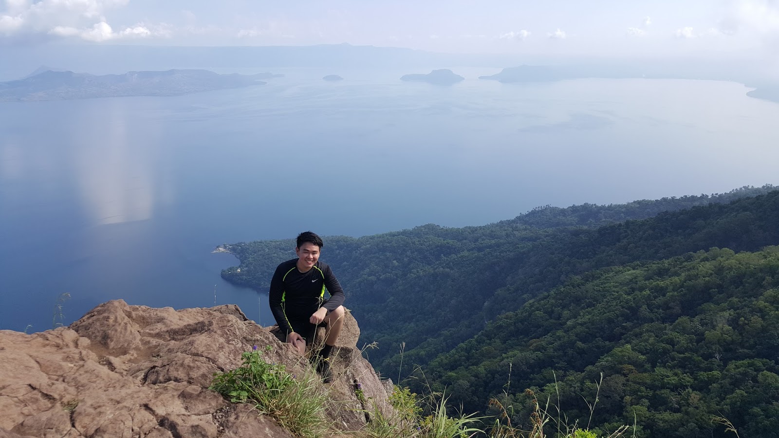
| A view of taal lake |

According to our tour guide, they are calling this fruit as "Tibig". He said that the fruit is not edible, but, when I searched it on the internet, I learned that the fruit is edible when ripe. It is also known as "Ficus Nota". The fruit and the tree have many uses.

We encountered this worm-like creature along the way.


At the Summit

There was no clearing when we reached the summit. It was a sea of fogs due to an upcoming rain.


The part of the descent that I found very thrilling was the rappelling. Since it already rained before we reached this point, the rocks became slippery that made it more difficult.
Grotto
The last part of the traverse is the grotto, a pilgrimage site. There, can be seen a mini statue of Mary, 2 white crosses, and fiesta with the landscape of the mountain in the background.

 |
| View from the grotto |
 |
| Panoramic View |
There are available tricycles at the end of the trail. Since another rain was approaching that time, we decided to take the ride going to Brgy. hall. We had our wash up at 1:40 and left at 2:00 pm
Side Trips
Since there was still time and we have a car, we visited some of the landmarks in Batangas.
 |
| Basilica of St. Martin of Tours |

 |
| The inside of the church |
 |
| Apacible's Museum |
Around the museum

 |
| The living room |

 |
| Some of their Kitchenware |
We left Batangas at 5:00 pm and arrived in Manila at 7:30 pm. Happy Independence!!!
Photo Credit: Santiago Cabangon
Actual Itinerary


The safe budget for a group of 3: 800 to 1000 pesos
For a commute trip, take a bus located in Buendia or Cubao bound to Lemery, drop off point is at Cuenca Batangas. There is available tricycle which can take you to the jump off.
End
- JSC